Hertfordshire Geological Society

Hertfordshire Geological Trails and Information Boards

We aim to add more trails and sites.
For church-specific trails, see the Church Guides page.

Geological Trails

St Albans town centre trail.

Click here for a downloadable pdf version.

St Albans: geological trail around St Michaels.

Click here for a downloadable pdf version.

Berkhamsted: Rectory Lane Cemetery.

“Family geology trail.”

Click here for a downloadable pdf version.

Building Stone Atlas of Hertfordshire

This is not a trail, but a great publication describing the use of the many types of stone used for buildings across Hertfordshire. It is well-illustrated, with sites identified so that you can visit to see for yourself.

Click here to visit the BGS Site to view and download the pdf.

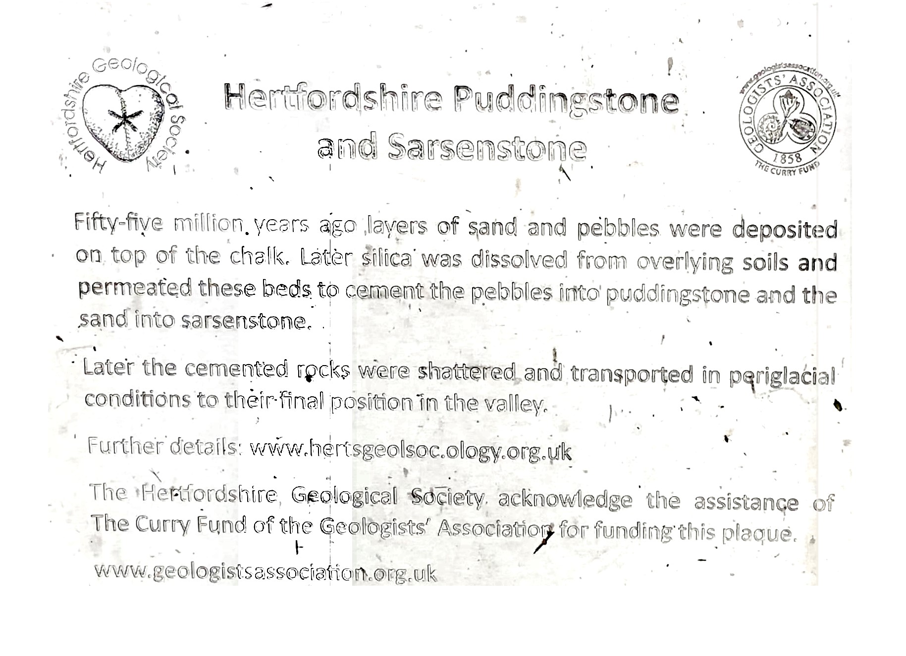
Geological information boards

Panshanger Country Park:
the Mimram valley near Hertford.

Click here for a downloadable pdf version.

Little Heath Pit:
Potten End near Berkhamsted
(TL 0165-0825)

Download a pdf image here or for pdf text here.
You can find more information on the SSSI page

Hill End Chalk Pit:
 On B651 approx 6km south of Hitchin.
(TL 197-239)

Download a pdf image here or for pdf text here.
You can find more information on the RIGS page

Barkway Chalk Pit:
 approx. 6 km SE of Royston.
(TL 381-366)

 Download a pdf image here or for pdf text here.
You can find more information on the RIGS page

Castle Hill, Berkhamsted
(SP 993-085)

Download a pdf image here or for pdf text here.
You can find more information on the RIGS page